University weather watch - Summer 2012
Fri, 07 Sep 2012 09:50:00 BST
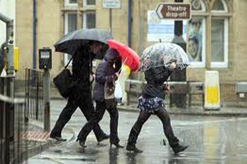 SINCE our records began at the School of Applied Sciences weather station in 1990, Huddersfield saw its fifth coolest July - with monthly mean temperatures over a degree cooler than average – and it was by far the wettest July experienced locally since our records began It was the third month this year to have a rainfall total of over 145mm this has never happened before in the history of our weather station.
The monthly mean temperature was 15.9˚C compared to the average figure for July of 17˚C, making it the coolest July since 2007. The warmest day of the month was Tuesday 24th with an average temperature of 21.9˚C, it was the warmest day experienced in July since the 1st July 2009. The maximum temperature of 28.1˚C was also recorded on this day, again the highest temperature for July recorded since 2009. The coldest day of the month was just a few days earlier on Friday 20th July when an average temperature of just 11.6˚C was recorded, the lowest minimum temperature of 7.6˚C was also recorded on this day.
It was by far the wettest July recorded since our records began with a total of 146mm of rainfall recorded compared to the average figure for July of 60.14mm! With a total rainfall of 30.8mm (21% of the months total rainfall) Monday 7th July was the second wettest July day since our records began (the wettest day was 30th July 2002 with 70.2mm). Two other days of the month were also particularly wet these being Thursday 5th with 27mm and Friday 6th with 26.2mm, these three days make up 57% of the months total rainfall. During the first three weeks of the month only two days of the month escaped rainfall and in total the month as a whole saw just eight days free of rain. The driest spell was between Sunday 22nd and Thursday 26th.
The mean wind speed for the month was 9.97km/hr. The highest mean wind speed was 19.44km/hr recorded on Sunday 7th. The highest gust of wind for the whole month was 95.4km/hr recorded on Friday 6th.
The prevailing wind direction for the month was west.
Warm and wet...
AUGUST was the warmest since 2009. However, our weather station recorded the lowest temperature and coldest day for August since our records began. Rainfall was slightly above average. The rainfall Huddersfield has received this year (January to August) 704.42mm already exceeds the yearly totals for the years 2009-2011 and we still have four months of rainfall to come!
Looking at the figures for the summer (June-August), Huddersfield received 364.82mm of rainfall compared to the average figure for the same period of 191.06mm (wettest summer period 2004 with 365.8mm). Experts have claimed it has been the wettest summer for over 100 years. The average figures are those recorded since 1990 from the School of Applied Sciences weather station.
The monthly mean temperature was 16.7˚C compared to the average for August of 16.8˚C. The warmest day of the month was Friday 17th with an average temperature of 20.7˚C. The highest maximum temperature of the month was 26.1˚C recorded on Friday 10th. With an average temperature of just 9.8˚C Thursday 30th was the second coldest August day recorded by our weather station since 1990 (9.7˚C was recorded in 1993).The lowest minimum temperature of 4.3˚C was also recorded on this day (average 7.7˚C) by far the lowest recorded temperature for August since our records began!
A total of 73.6mm of rainfall was recorded during the month slightly higher than the average figure of 68.4mm making it the eight wettest August since 1990. The wettest day of the month was Wednesday 15th with 13.2mm (18% of the month’s total) of rainfall. Ten days of the month escaped rainfall, the driest spell falling between Wednesday 8th and Saturday 11th inclusive.
The mean wind speed for the month was 7.27km/hr. The highest mean wind speed was 16.56km/hr recorded on Wednesday 22nd. The highest gust of wind for the whole month was 83.16km recorded on Sunday 15th.
The prevailing wind direction for the month was south west.