University weather watch - September 2012
Tue, 09 Oct 2012 10:42:00 BST
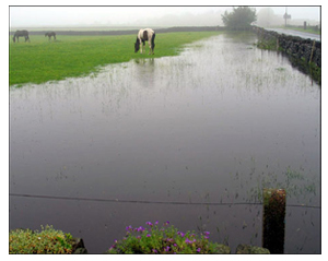
Rain again! It was the second wettest September since 1990
 The beginning of the month saw nine days with no rainfall and temperatures reaching over 25˚C. But the rest of September experienced rainfall on every day, with below average temperatures.
The monthly mean temperature was 13.24˚C compared to the average figure for September of 14.24˚C, making it the coolest September since 1994. The warmest day of the month was Sunday 9th with an average temperature of 19.4˚C. The maximum temperature of 25.8˚C was also recorded on this day. The coldest day of the month was Friday 21st, with an average temperature of just 7.4˚C. The lowest minimum temperature of 2.6˚C was also recorded on this day.
It was the second wettest September since 1990, with a total of 110.8mm of rainfall compared to the average figure of 61.45mm. With a total of 33.8mm of rainfall - 30.5% of the month’s rainfall - Monday 24th was the wettest day of the month making it the second wettest September day since our records began in 1990 at the School of Applied Sciences weather station and the second wettest day of 2012 so far. The driest spell was between Saturday 1st and Saturday 8th inclusive.
The mean wind speed for the month was 13km/hr. The highest mean wind speed was 21.96km/hr, recorded on Sunday 23rd. The highest gust of wind for the whole month was 83.16km/hr recorded on Thursday 13th.
The prevailing wind direction for the month was southwest.