Playing it cool
Tue, 12 Mar 2013 13:58:00 GMT
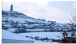
January started off as a very mild month with average temperatures for the first half of the month slightly higher than average, however, temperatures for the second half of the month fell dramatically leaving the overall average figure for January over a degree lower than average. Snow and ice caused some disruption during the month. The average figures are those recorded by the Applied Sciences weather station since 1990.
The monthly mean temperature was 3.93˚C - over a degree cooler than the average figure for January of 5.12˚C,making it the coolest January since 2010. The warmest days of the month both with an average temperature of 10.7˚C were Thursday 3rd and Tuesday 29th. The highest maximum temperature of 13.5˚C was recorded on Tuesday 29th, the highest recorded temperature for January since 2008. The coldest day of the month was Wednesday 16th with an average temperature of -2.8˚C. The lowest minimum temperature of -4.2˚C was recorded on Tuesday 15th. The temperature fell below zero on 12 days of the month.
 Precipitation figures for the month may have been slightly distorted due to snow and snow melt. A total of 53.6mm of precipitation was recorded during the month much lower than the average figure for January of 92.3mm. The wettest day of the month (but this could be snow melt) was Saturday 26th with 16mm (30% of the month’s total) of rainfall. Twelve days of the month escaped rainfall.
The mean wind speed for the month was 10.8km/hr. The highest mean wind speed was 28.08km/hr recorded on both Monday 28th and Thursday 31st.
The prevailing wind direction for the month was south west.
IT was the fourth coldest February recorded since our records began in 1990 with temperatures struggling to hit double figures on only three days of the month. February was also the seventh driest February since our records began; precipitation was much lower than average for the second consecutive month. The average figures are those recorded by the Applied Sciences weather station since 1990.
The monthly mean temperature was 3.54˚C - nearly two degrees colder than the average expected for the time of year of 5.43˚C making it the fourth coldest February since our records began and the coldest since 2010. The warmest day of the month was Sunday 3rd with an average temperature of 8.5˚C (average 10.56˚C).
 The highest maximum temperature of 10.7˚C was recorded on Tuesday 19th. The coldest day of the month was Friday 22nd with an average temperature of just 1˚C. The months minimum temperature of -1.9˚C was recorded on both Monday 18th and Wednesday 27th. The temperature fell below zero on four days of the month.
Precipitation figures for the month may have been slightly distorted due to snow and snow melt. A total of 49.2mm of precipitation was recorded during the month compared to the average figure for February of 72.3mm making it the driest February since 2009 and the seventh driest since our records began. The wettest day of the month was Monday 4th with 19.6mm (27.1% of the month’s total) of rainfall. Fourteen days of the month escaped rainfall the driest spell falling between Wednesday 20th and Sunday 24th however only 1.6mm of rain fell between Thursday 14th and Thursday 28th.
The mean wind speed for the month was 11.23km/hr. The highest mean wind speed was 22.32km/hr recorded on both Monday 4th and Monday 25th. The highest gust of wind for the whole month was 100.44km/hr recorded on Wednesday 6th.
The prevailing wind direction for the month was south west.